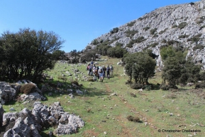
This part of the E4 path has as its main feature the ascent of Mount Kryoneritis, which has panoramic views of the northern and southern coast of Crete. The course continues north and ends at Alones village.
Mount Kryoneritis (meaning Cold Water) rises in south Rethymno prefecture and is quite steep, reaching the highest peak at an altitude of 1310m. The rocky grounds are rough limestone and the few trees are mostly limited to maples and hollies.
The mountain is crossed by the European Hiking foottrail E4 that connects Rodakino with Alones. Another vertical trail also climbs to the peak, a few meters above the temple of the Holy Spirit (Agio Pnevma) with the water spring that gives the name Kryoneritis to the mountain. From the peak, one descend to the village Miriokefala.


