- Home
- Nature
- ⭐ Travel Guide for Island Crete ⛵, Greece❗ - Nature
Nothing is repeated in Crete. Enormous geological contradictions and special weather conditions have formed unique landscapes, surprising the visitors and keeping senses constantly alert.
Each route in Crete is unique. Variant sensations, pictures, colors, flavors, sounds accompany visitors at every step.
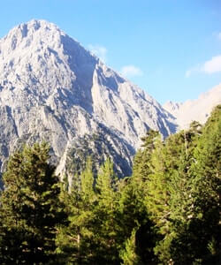
One can encounter emerald beaches, scrublands, sand dunes, rocky summits, steep slopes, alpine zones, verdant mountains, deep gorges, dry lands, gurgling rivers, scenic ponds, Mediterranean woods, wetlands, fertile meadows, vineyards and olive groves, while the same contrasts are met below sea surface.
Those contradictions favor the development of different ecosystems, significantly increasing the biodiversity of the island.
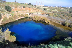
Almiros spring can probably most satisfactory explain the term paradox. This spring is located at the northeastern side of Psiloritis, a few hundred meters far from the sea and the city of Heraklion, and it runs off the highest water quantity in Crete directly into the sea through the homonym river of Almiros! The water of the spring is brackish because somewhere quite deep it is mixed with seawater.
Read more ...
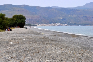
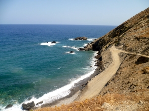
The long beach in Rapaniana is located 20km west of Chania and 4km east of Kolimbari. It is just a part of the vast beach stretching from Cape Rodopos to Chania, including the beaches in front of Skoutelonas, Minothiana and Rapaniana villages.
Read more ...
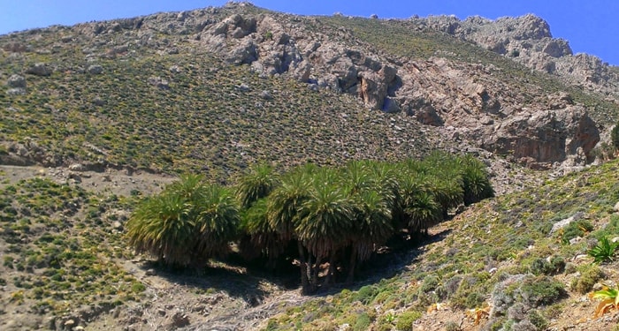
If you walk along the coast to the north of Maridati till Vai palmgrove, you will meet several small coves, totally secluded accessed only by boat or on foot (it takes 2:30 hours to reach Vai). The most beautiful beach is located at the middle of the distance (Vai-Maridati) and is named Kedromouri, i.e. cedar Cape, after the trees in the area.
Read more ...
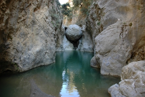
Through the gorge passes Havgas river that carries water from the plateau of Katharo to Lassithi. Then the water reaches Chonos (the hole from which waters of the Lassithi Plateau escape the plateau), comes out from Fleves and reaches Aposelemis dam. The river has water for several months a year. Thus, make sure you get properly informed about the weather because the canyon carries a lot of water during periods of rainfall.
Read more ...
he beaches of Skepasti are located about 27km east of Rethymnon and 2km east of the homonym village Skepasti, in the province of Milopotamos. The beaches are mainly accessed through bad dirt tracks that starts from the village. Skepasti beaches are all open to the north winds, with pebbles and deep water.
Read more ...
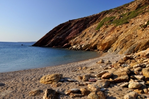
Louros is a rocky area between the settlements of Agios Georgios by Agia Galini and Agios Pavlos, hosting several small beaches. There is a road running above them all. Driving west from Agios Georgios, we soon meet the small beaches of Armenopetra (i.e. sailing rock) named after a lonely boulder in the sea. The beaches are ideal for snorkeling.
Read more ...
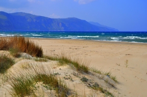
At the point where the prefecture of Rethymno meets Chania, east of Georgioupolis beaches, we find the beaches of Kavros and Kournas. The place at its greatest part is developed and only a very small part of it has been left untouched. Between this remaining virgin parts of the beach there is an extensive and very important ecosystem of dunes.
Read more ...
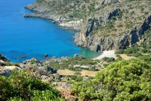
The beach of Lissos is located at position Ai-Kyrkos (Agios Kyrikos) about 71km south of Chania and 3 km west of Sougia. It is the site of ancient Lissos, which was actually the seaport of another town, called Elyros. The ruins of Elyros are located close to today's village Rodovani.
Read more ...
")