")


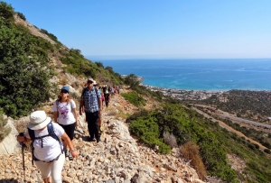
During the First World War, Bulgarian war captives were brought to Crete to reconstruct the path connecting Stalis to Mohos. Thus, they built a wider path with an average width of 2m, which for its time was a project of enormous importance. Of course, after the main road was built in the 20th century, the use of the trail virtually disappeared and now attracts only hikers.

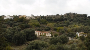
Margarites is a village, well known for its marvelous architecture and the traditional pottery. However, in the wider area of the villages of Margarites, Orthe and Eleftherna appear a series of small, parallel gorges. Small streams such as Margaritianos flow towards the north and are tributaries of the Geropotamos River. The gorges are developed in white-yellow marly limestone of the Upper Miocene period (8-10 million years ago) as a result of the uplift of the whole area and the erosion by water.

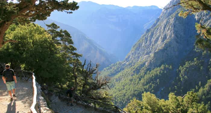
The route starts from Kissamos and is the first part of the European E4 trail in Crete. After crossing the villages Kato Palekastro, Korfiano and Grigoriana, we arrive at the ancient city of Polirinia and from there we cross the lush green villages Galouva, Lusakies Zahariana and, finally, Sfinari with the beautiful beach.
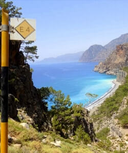
Climbing on Giouchtas is very easy because there is a very nicely marked and visible trail that crosses the mountain from one side to the other. Giouchtas has amazing and unobstructed views towards all directions, although it is quite low (its highest peak reaches 811m altitude). The trail that crosses the mountain starts right next to very famous archaeological site of Anemospilia and ascends to the south having panoramic views across the north side of the city of Heraklion, the Cretan Sea.
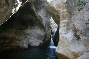
The Gorge of Chochlakies or Karoumes is located in one of the most isolated areas of the island, near Kato Zakros. Easy hiking in the snakelike canyon with the sparse vegetation and the bare rocks, ends in the amazing beach of Karoumes, where being totally alone is the rule.
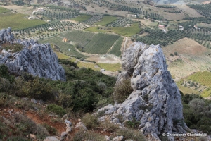
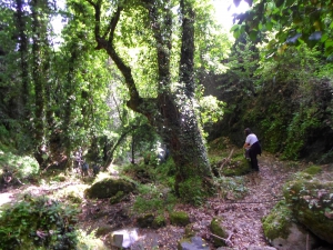
Kollita Gorges, i.e. Twin Ravines are located nearby the picturesque village Argyroupolis, about 22km southwest of Rethymnon city. They are named so, as they consist of two parallel canyons that end near Kato Poros settlement and is part of the E4 trail. The first canyon on the east is called Moudriano Gorge, while the west gorge is Kato Poros Gorge of Vilandredo Gorge, mostly known as the main Kollita Gorge.

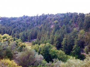
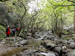
The lush canyon of Boriana (mainly known as Karanou Gorge) starts from the village Boriana and joins the River Mavropiliotis after 1800 meters in a nicely landscaped trail. Along the trail we meet a ruined watermill, caves, entrances of the old iron ore quarries (known locally as quarries of Averof), a charcoal furnace and galleries.
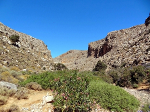
Gorge Smiliano or Kalamafka is located north of the village Ano Meros, about 100km southwest of Heraklion city. Through the gorge runs the Lygiotis river which is supplied by the valleys of Gerakari and the slopes of Samitos Mount. The canyon has a lot of water in winter and crossing it, by any means, is very tough.
Also read:
- Home
 Beaches
 Nature
 Past
Past Destinations
 Highlights
 West Crete
- Central Crete
- East Crete
- Towns
- Chania Prefecture
- Chania
- Paleochora
- Kissamos
- Georgioupolis
- Chora Sfakion
- Loutro
- Rethymnon Prefecture
- Rethymnon
- Agia Galini
- Plakias
- Spili
- Anogia
- Heraklion Prefecture
- Heraklion
- Hersonissos
- Malia
- Matala
- Agia Pelagia`
- Archanes
- Kokkinos Pirgos
- Lassithi Prefecture
- Agios Nikolaos
- Elounda
- Sitia
- Ierapetra
- Makrigialos
- Palekastro
- Zakros
- Lassithi Plateau
- Get Prepared


