")


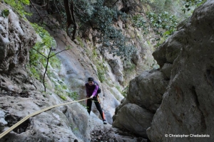
Petrigiari is a small and wild gorge located parallel to the wild gorge of Kakoperatos, at the south coastline of Central Crete. The canyon is only accessible with technical (canyoning) equipment) with the maximum rapel being about 15m. The gorge ends at an amazing tiny pebbly beach with caves and crystal clear deep blue water.

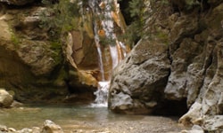
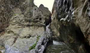
At the lowest point of the ruined village Kolokasia, Sfaki Provice, at the church of the Virgin Mary starts forming a stream. The stream collects the water of the village. After crossing the olive grove of the village it turns to a small, but rugged, gorge called Rechtas or Rektas. Its name means waterfall in the local dialect. A few meters after the start the gorge it forms, indeed, a spectacular waterfall about 20 meters high.
Gorge Koumos is located at the area of Kapetaniana and it ends near the seaside settlement of Agios Ioannis, in a area full of pine trees. It is an unknown gorge and it can only be accessed with technical equipment. It is generally dry but after some heavy rainfalls it forms spectacular waterfalls.

Below the village Myrthios of North Rethymnon (not the village Myrthios by Plakias) a small ravine with plane trees is formed, with a small and very wild gorge formed at its exit at position Kaminolakos. The gorge is dry and carries water only after heavy rainfall.

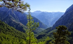
Half an hour above the archaeological site of Lissos, in a totally secret position called Lichnou Laki there is a small and very beautiful canyon. The gorge is located in the district of Selino, below Prodromi village, south of Chania and its entrance is accessed by a dirt road that runs from the village (to the south). The very small canyon is quite green and is divided into two different sections. The first section is dominated by lentisks, junipers and oaks and the second is covered by pine trees despite the destructive fire that had previously burnt the region.
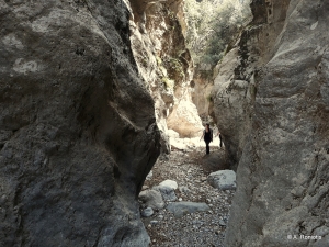
Adjacent and parallel to the current highway linking Heraklion to Messara plane, between the villages Prinias and Avgeniki, a beautiful canyon is formed. Its descent requires the use of canyoning equipment, as it forms some steep descents.
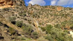
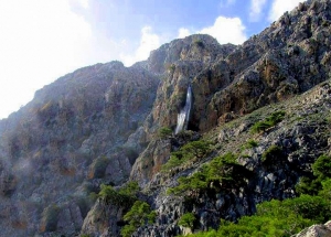
On the southeast side of Mount Sanida, near the village Skourvoula, a small but very wild gorge is formed called Rizopetro. The gorge ends near Faneromeni dam after a very impressive 60m high waterfall, having water only after heavy rainfalls.

Βoufanis gorge is formed southeast of Selakano and finishes between the villages Chirstos and Metaxohori of Viannos Province. Hiking is usually done by the old path that connects Selakano with Metaxochori and it passes high and parallel to its bed.
Also read:
- Home
 Beaches
 Nature
 Past
Past Destinations
 Highlights
 West Crete
- Central Crete
- East Crete
- Towns
- Chania Prefecture
- Chania
- Paleochora
- Kissamos
- Georgioupolis
- Chora Sfakion
- Loutro
- Rethymnon Prefecture
- Rethymnon
- Agia Galini
- Plakias
- Spili
- Anogia
- Heraklion Prefecture
- Heraklion
- Hersonissos
- Malia
- Matala
- Agia Pelagia`
- Archanes
- Kokkinos Pirgos
- Lassithi Prefecture
- Agios Nikolaos
- Elounda
- Sitia
- Ierapetra
- Makrigialos
- Palekastro
- Zakros
- Lassithi Plateau
- Get Prepared


