")


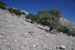
The carob wood of Tris Ekklisies is located 64km south of Heraklion, next to the village of Tris Ekklisies. The area, one of the most secluded in Europe, is very difficult to reach, as a very rough dirt road 10km long starts from the village Paranymi, runs across the wild Asterousia Mountains and ends at the beach level.
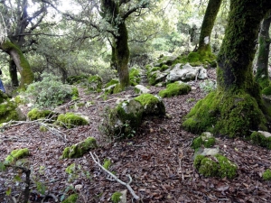
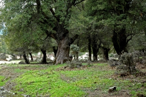
The holm oak wood (Azilakodasos) is located 11km west of Vrachasi and 9km south of Malia, in the foothills of Mount Selena. The small forest can be accessed either by walking the smooth path from Krassi village or by following the trail from Malia that runs uphill. There is also a small network of forest dirt roads in the area.


The spring and the cave of Kormokopos is located northwest of Agios Ioannis, on the east side of the canyon Eligia. The path from Agios Ioannis needs about 1.5 hour. It starts as a beautiful walk through the forest of old pine and cypress trees, and ends, almost suddenly in a wild and imposing landscape.

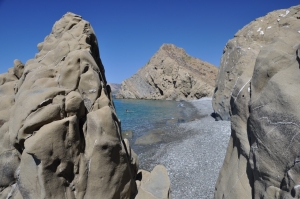
West of Platia Peramata village, there is another smaller settlement called Krigioi. In front of Krigi, there is a small cove with fine pebble and crystal clear water. Krigi beach is ideal for seclusion, snorkeling and fishing. West of Krigi, you'll reach another pebbly remote beach. Some more meters on the west you'll find the three consecutive beaches of Kokkines Plakes (i.e. Red Rocks), named after the reddish rocks around and accessed mainly through sea.

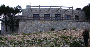
At Greleska location of the White Mountains since 1999 operates an observatory for the endangered Cretan Ibex in a beautiful stone building. There is a reception desk, information room, exhibition and an accommodation room for the guard. The area is very beautiful with cypress trees and views to the gorge of Agia Irini.

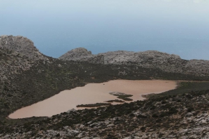
The name means the lake of the Turk, taken after a legend according to which a Turk was drowned here. In order to reach the lake you should follow the dirt track from Ahendrias to Stiromandra. From Stiromandra follow the short path which is part of the old trail from Ahendrias to Agios Nikitas monastery.

The Plateau of Vromonero or Lakkos Limas is located at an altitude of 1300m, 10km west of the village Kroussonas, in an amazing location east of the summit Skinakas of Psiloritis Mt, where the homonym observatory of the University of Crete is located. It can be accessed via a dirt track running through the gorge of Halasia, which starts from Livadi plateau and ends in Krousonas.
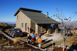
The shelter is located at position Strovili at an altitude of 1533m over Limnakaro Plateau at Dikti Range. It can be accessed either by walking 2:30 hours from Avrakontes village or by driving the dirt road from there. From here one can hike to the peaks Spathi (2148m) and Afendis Christos (2141m). The shelter can accommodate 12 people. . It is available upon request to its operator, i.e. the Mountaineering Club of Lasithi (www.fysi.gr).
Also read:
- Home
 Beaches
 Nature
 Past
Past Destinations
 Highlights
 West Crete
- Central Crete
- East Crete
- Towns
- Chania Prefecture
- Chania
- Paleochora
- Kissamos
- Georgioupolis
- Chora Sfakion
- Loutro
- Rethymnon Prefecture
- Rethymnon
- Agia Galini
- Plakias
- Spili
- Anogia
- Heraklion Prefecture
- Heraklion
- Hersonissos
- Malia
- Matala
- Agia Pelagia`
- Archanes
- Kokkinos Pirgos
- Lassithi Prefecture
- Agios Nikolaos
- Elounda
- Sitia
- Ierapetra
- Makrigialos
- Palekastro
- Zakros
- Lassithi Plateau
- Get Prepared


