")


The Small Plateau of Nissimos is located 55km southeast of Heraklion, on the northern side of the Lassithi Plateau, at an altitude of 890m. Access is quite easy as there is a passable uphill road, 2.5km long, starting from the village Tzermiado.

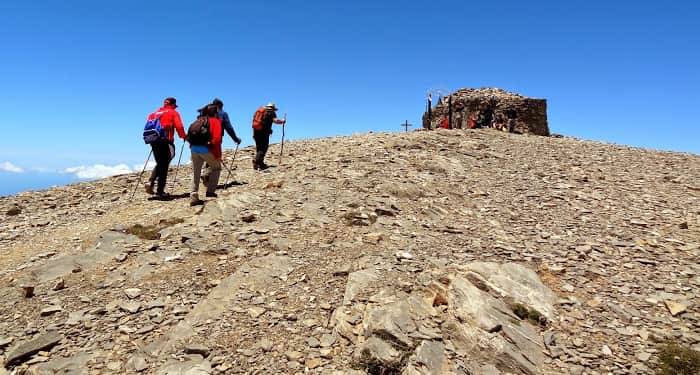
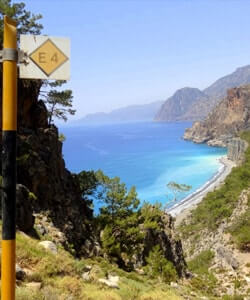
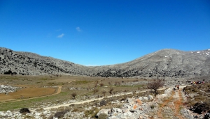
The route starts from Spili, reaches the spring of Agia Fotia, and then ascends to Kissos. It comes above the Monastery of the Holy Spirit and climbs to the summit of Mount Kedros (1776 m.). From there we go back and meet the trail that leads to the Church of the Prophet Elijah and descends to Gerakari. This route is a part of the European E4 trail.

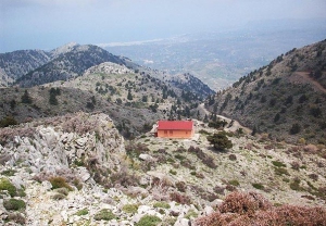
The shelter Volikas is located at an altitude of 1450m near the village Kambi, Keramia, at northern White Mountains. It can be accessed by 3 hours hiking from Kambi, while the nearest point where a dirt road reaches (starts from the village Madaro) requires 10 minutes course. From this refuge someone can walk to the nearest peaks, towards all directions.

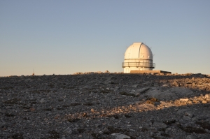
The Skinakas Observatory is a research facility operated jointly by the Foundation of Research and Technology - Hellas (F.O.R.T.H.), the University of Crete and the Max Planck Institute for Extraterrestrial Physics of Germany.

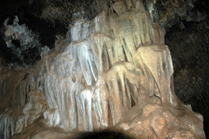
Mougri cave is located in the middle of Kouloukonas mountains, just northwest of Vossakos monastery. It was formed within the “Plattenkalk” rocks, probably along one of the big faults in the area.

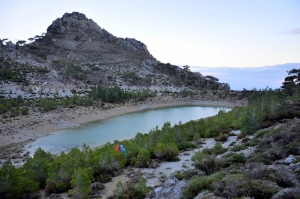
The secluded lake is the unique lake at Thripti and gets its name (skafi means tub in Greek) after its oblong shape. During spring, water is very clear and is perfect for a cold bath. To access this amazing place, follow the dirt track west of Orino village and after 2km walk or drive along the concrete chute that carries water from the mountains to the lake.
The shelter of Samari or Toumbotos Prinos is located at an altitude of 1600m on the western outskirts of Psiloritis Mt. The shelter can be accessed by hiking 4 hours from Fourfouras village (part of the European E4 foot trail) or driving in a 12km long dirt road starting from the village Kouroutes.

- Home
 Beaches
 Nature
 Past
Past Destinations
 Highlights
 West Crete
- Central Crete
- East Crete
- Towns
- Chania Prefecture
- Chania
- Paleochora
- Kissamos
- Georgioupolis
- Chora Sfakion
- Loutro
- Rethymnon Prefecture
- Rethymnon
- Agia Galini
- Plakias
- Spili
- Anogia
- Heraklion Prefecture
- Heraklion
- Hersonissos
- Malia
- Matala
- Agia Pelagia`
- Archanes
- Kokkinos Pirgos
- Lassithi Prefecture
- Agios Nikolaos
- Elounda
- Sitia
- Ierapetra
- Makrigialos
- Palekastro
- Zakros
- Lassithi Plateau
- Get Prepared


