")


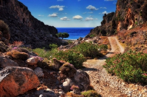
Gorge Katsounaki is located in the dry Eastern Crete, east of Xirokambos settlement. The river passing through the gorge leads to the beach of Xerokampos River, next to the beautiful sand beach of Alona. Hiking in the canyon is easy and the landscape with tall walls is very wild. You can walk upside down from Alona.
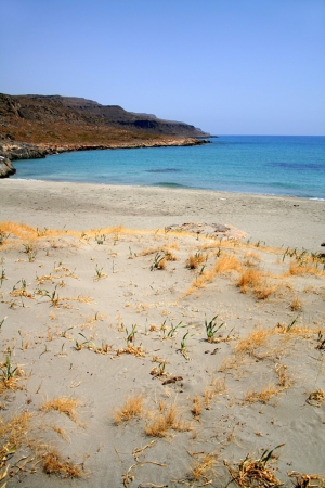
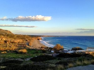
In Xerokampos the landscape is arid and truly eerie, characterized by bare rocks and steep mountains. The vegetation is limited to bushes and there are some places with a few olive groves. A small tourist destination has started developing during the last years, especially after the roads were paved with asphalt.
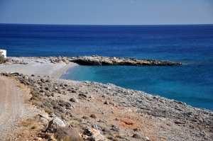
500m west of settlement Xerokambos you will meet the first hotels in the area and the long beach of Mazida Ammos, the largest beach of Xerokambos. Mazida Ammos, falsely known as Amatos, is a beautiful un organized beach with white sand and turquoise swallow waters. It is well protected on the east by Cape Trachilos, on the edge of which there is a sealcave.
Agia Irini is a small remote picturesque village located 98km southeast of Agios Nikolaos and 11km south of Ziros village. You can reach the village via dirt tracks starting either from Kalo Horio or from Hametoulo (both 7km long). The village is the starting point of the rugged Agia Irini Gorge that exits in one secluded cove, opposite the small islet of Hamili.
Livari is located 90km southeast of Agios Nikolaos and 7km east of Goudouras, in one of the most remote areas of Crete where you can be truly alone. 2km east is the large power plant of Atherinolakkos, which is the only drawback in the landscape.
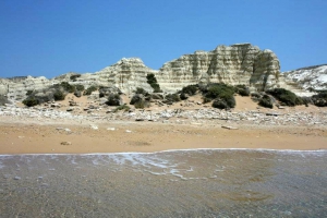
The area of Asprougas could easily be described as an open-air geological museum, full of fossils (one slope of the area is fully covered with fossils from an extinct species of snail). Besides the rich fossils, the morphology of the whole area with the white and stripped rocks scattered everywhere is amazing.
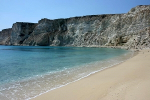
In the southeastern part of the magic island is formed Chiliaderfia Bay with 4 beaches and 2-3 islets colored by the characteristic white color of the rocks of the area, which in ancient times gave the island its name Lefki (i.e. white). All beaches have shallow water, as clear as anywhere in Crete, and fine golden sand.

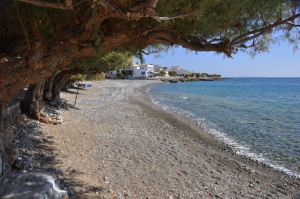
The village has faced a very mild touristic development, which makes it a very quiet destination even in August. Along the seaside village road stretches a large pebbly beach with clean and cool water, not very well organised, although there are some places with umbrellas and taverns nearby. After swimming you can enjoy the famous local fish.
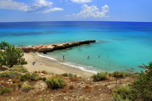
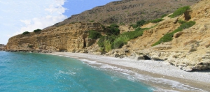
Votsalaki (or Botzalaki) is located 71km southeast of Agios Nikolaos and 36km east of Ierapetra, on the west end of Goudouras, at the position of Aspra Chomata (White Soil). It is situated amid the arid and rugged landscape of East Crete, close to the exit of the wild Gorge Asprolithos.
The first beach you meet is called Kalami and is named after the reeds (kalami in greek) that are next to it. It is a nice pebbly beach, perfect for seclusion with a spring with fresh water on the beach! There are no tall trees on the beach, but there is a big cave offering natural shade to its visitors, all day round.
Kalo Nero is located close to Kapsa Monastery, 68km south of Agios Nikolaos and 33km east of Ierapetra, in one of the most rugged areas of eastern Crete. It is a small village at the outlet of a small, but inaccessible, rocky canyon. You will see the church of Panagia (1881), around which the inhabitants of the mountainous village Pervolakia built buildings to stay, when they brought their cattle to graze here. The church was built on the remains of an older chapel, owned by Kapsa Monastery, which was built in 1461.
Ammoudi is located 66km southeast of Agios Nikolaos and 29km east of Ierapetra, just next to the road connecting Makrigialos and Goudouras. It's main beach is also called Dragon's Cave, due to a large cave 500m north of the beach and the homonym tavern next to it. There are 2 more secluded coves west of Dragon's Cave beach, both accessed on foot or dirt track.
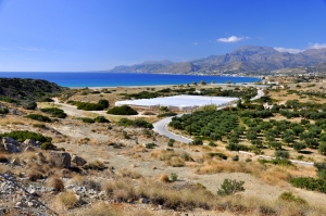
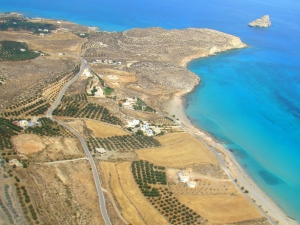
Lagada is located 29km east of Ierapetra and 62km southeast of Agios Nikolaos, near Makrigialos (6km). It is situated in a large fertile valley with many olive groves, which is surrounded by the tall mountains of Makrigialos. During the last years, some hotels and rooms to let have been built, but the beach still retains its remoteness.
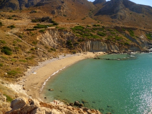
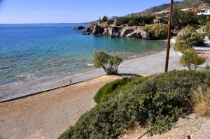
Diaskari is located 27km east of Ierapetra and 62km southeast of Agios Nikolaos, quite close to Makrigialos (4km). It is a long beach with coarse white sand and crystal clear waters, but you should be careful when entering the sea because there are smooth slippery rocks at some points.
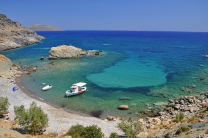
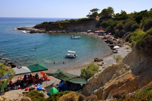
Lagoufa is located right after the east end of Makrigialos main beach, around 59km southeast of Agios Nikolaos and 24km east of Ierapetra. It consists of two adjacent protected coves, which are formed near the big hotels of Makrigialos.
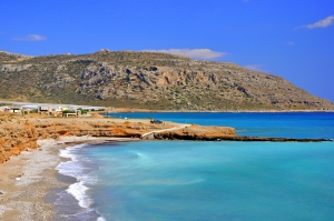
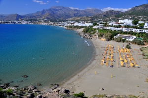
Makrigialos is located 58km southeast of Agios Nikolaos and 23km east of Ierapetra. It is a large village, located near the exit of the lush canyon of Pefki. Being initially a humble harbor with no roads in the ‘50s, Makrigialos has faced strong growth and has become the largest tourist destination in the region. It actually consists of two settlements, Makrigialos and Analipsi, which are now united.
Kalamokanias is located 57km southeast of Agios Nikolaos and 22km east of Ierapetra, on the west side of Makrigialos settlement. It is located on the west side of the hill that rises behind the harbor area. It takes its name after the migratory bird stilt (Himantopus himantopus) that has red legs and body reminding of a miniature stork and stops in the local streams.
Koutsouras is located 55km southeast of Agios Nikolaos and 20km east of Ierapetra, on the main road between Ierapetra and Makrigialos. It is a relatively new village, built in a valley with pine trees, greenhouses and olive groves on the southern foothills of Mount Thripti. The village is developed with a police station, pharmacy, clinic, hotels, restaurants, supermarkets, etc., but it is still a very quiet place.
The place is known as Maheridia and is one of the favorite beaches of locals, which is quite unknown to everybody else. The beaches are not visible from the main road running next to them, thus you have to walk till you meet them. They are surrounded by vertical cliffs, however there are some primitive trails to the beach.
Mavros Kolimbos or Agios Panteleimon is located 51km southeast of Agios Nikolaos and 16km east of Ierapetra. It is a small settlement near the shore, that has faced a mild development during the last decades. There are some rooms to rent around and some small taverns.
Also read:
- Home
 Beaches
 Nature
 Past
Past Destinations
 Highlights
 West Crete
- Central Crete
- East Crete
- Towns
- Chania Prefecture
- Chania
- Paleochora
- Kissamos
- Georgioupolis
- Chora Sfakion
- Loutro
- Rethymnon Prefecture
- Rethymnon
- Agia Galini
- Plakias
- Spili
- Anogia
- Heraklion Prefecture
- Heraklion
- Hersonissos
- Malia
- Matala
- Agia Pelagia`
- Archanes
- Kokkinos Pirgos
- Lassithi Prefecture
- Agios Nikolaos
- Elounda
- Sitia
- Ierapetra
- Makrigialos
- Palekastro
- Zakros
- Lassithi Plateau
- Get Prepared


