")


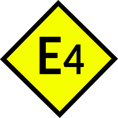


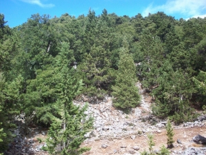
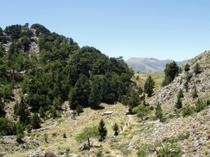
Kollita Gorges, i.e. Twin Ravines are located nearby the picturesque village Argyroupolis, about 22km southwest of Rethymnon city. They are named so, as they consist of two parallel canyons that end near Kato Poros settlement and is part of the E4 trail. The first canyon on the east is called Moudriano Gorge, while the west gorge is Kato Poros Gorge of Vilandredo Gorge, mostly known as the main Kollita Gorge.
- Length (km): 4
- Type: Hiking gorge, Signed trail, E4 trail
- Location: Rethymnon Prefecture
- Water: Water till spring, Springs
- Difficulty (0-10): 2
- Altitude difference (m): 180
- Hiking Hours: 2.5
- Accessibility: Paved road
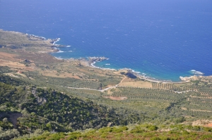
The route starts from Kissamos and is the first part of the European E4 trail in Crete. After crossing the villages Kato Palekastro, Korfiano and Grigoriana, we arrive at the ancient city of Polirinia and from there we cross the lush green villages Galouva, Lusakies Zahariana and, finally, Sfinari with the beautiful beach.
- Length (km): 22
- Type: E4 trail
- Location: Chania Prefecture
- Difficulty (0-10): 1
- Hiking Hours: 5:00
- Accessibility: Paved road
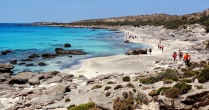
This part of the European trail E4 starts from Sfinari and ends at Chrisoskalitissa. It is one of the most beautiful and wooded parts of Crete with astonishing sea views. First we go through the desolated village Ano Sfinari, then Kambos, Plagia and Keramoti.
- Length (km): 31
- Type: E4 trail
- Location: Chania Prefecture
- Difficulty (0-10): 1
- Hiking Hours: 7:00
- Accessibility: Paved road
- Length (km): 18
- Type: E4 trail
- Location: Chania Prefecture
- Difficulty (0-10): 1
- Hiking Hours: 3:30
- Accessibility: Walking
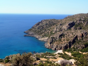
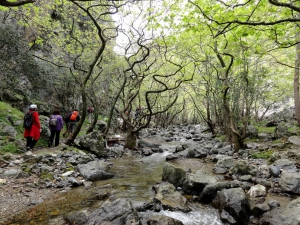
This amazing hike is about 16km long and takes about 5-6 hours. The trail is clear and well-marked with the typical E4 back-yellow signs. It crosses the archaeological site of Lissos, where you can find water from the local spring. It isn't too difficult but plenty of water, sun protection, and steady shoes are recommended.
- Length (km): 16
- Type: E4 trail
- Location: Chania Prefecture
- Difficulty (0-10): 1
- Hiking Hours: 5:00
- Accessibility: Walking
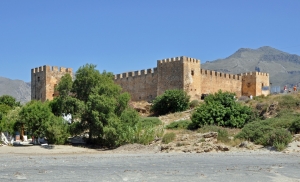
The part of the European path E4 that connects Chora Sfakion with Frangokastelo and then with Rodakino is all on paved road and can be visited even by car.
- Length (km): 28
- Type: E4 trail
- Location: Chania Prefecture, Rethymnon Prefecture
- Difficulty (0-10): 1
- Hiking Hours: 7:00
- Accessibility: Paved road
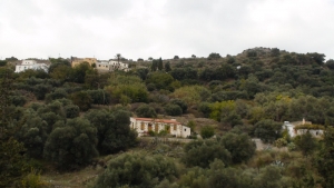
Starting from Sougia, apart from the gorge of Agia Irini, we can choose the alternative route that comes through the beautiful settlement Koustogerako. Then the trail continues and crosses the pine wood by Olisma and conludes at Seliniotikos Gyros, i.e. the southwest passage to Omalos Plateau.
- Length (km): 22
- Type: E4 trail
- Location: Chania Prefecture
- Difficulty (0-10): 2
- Hiking Hours: 7:00
- Accessibility: Paved road, Dirt track, Walking
Some of those who cross the gorge of Agia Irini, start their course from the plateau Omalos and reach the village of Agia Irini, before entering the canyon via the E4 trail. The trail has amazing views to the groves with the full of the typical cypress trees of the White mountains.
- Length (km): 5
- Type: E4 trail
- Location: Chania Prefecture
- Difficulty (0-10): 1
- Hiking Hours: 2:00
- Accessibility: Paved road, Walking
Also read:
- Home
 Beaches
 Nature
 Past
Past Destinations
 Highlights
 West Crete
- Central Crete
- East Crete
- Towns
- Chania Prefecture
- Chania
- Paleochora
- Kissamos
- Georgioupolis
- Chora Sfakion
- Loutro
- Rethymnon Prefecture
- Rethymnon
- Agia Galini
- Plakias
- Spili
- Anogia
- Heraklion Prefecture
- Heraklion
- Hersonissos
- Malia
- Matala
- Agia Pelagia`
- Archanes
- Kokkinos Pirgos
- Lassithi Prefecture
- Agios Nikolaos
- Elounda
- Sitia
- Ierapetra
- Makrigialos
- Palekastro
- Zakros
- Lassithi Plateau
- Get Prepared


