")


This part of the E4 trail starts from the historical monastery of Arkadi, heads to antiquities of the ancient town Eleftherna and then concludes at the village Margarites. The highlights of the route include the monastery of Arkadi, the ancient necropolis and the Roman cisterns in Eleftherna and the traditional houses of Margarites.

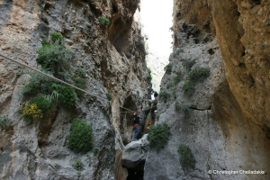
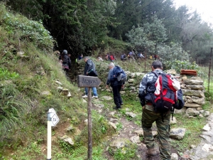
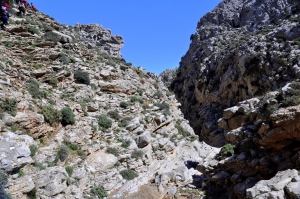
At the drier side of Crete, near the seaside village Goudouras of Sitia Province we meet fouir parallel gorges of unique beauty. All of them are technical and descent requires rope. At the driest side of Crete, near the seaside village Goudouras of Sitia Province we meet fouir parallel gorges of unique beauty. All of them are technical and descent requires rope.

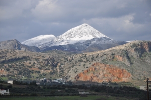
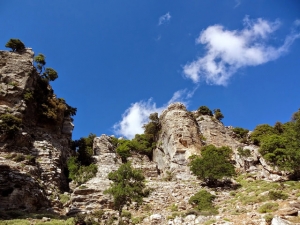
Strouboulas is the first peak that one can see from Heraklion when looking to the west. The height of the tops is 798 meters above sea level, a small altitude compared to the surrounding mountains and the range of Psiloritis it actually belongs. What makes Strouboulas special and beloved by the locals is its shape reminiscent of the pyramid or volcano when looking from Heraklion. In fact, however, its shape is elongated from east to west but from the city it looks like a perfect pyramid.

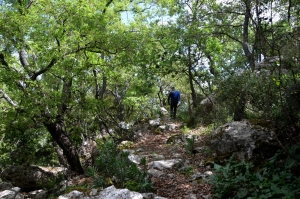
From the lush mountain village of Gerakari, Amari province, in Rethymno starts one of the trails that climbs Mount Kentros and attracts many walkers. But there is a second mountain trail unknown to most, the path leading from the village to the historic cave Chainospilios. This path was cleaned with an exemplary manner, while an explanatory sign that describes the path has been placed at its starting point.

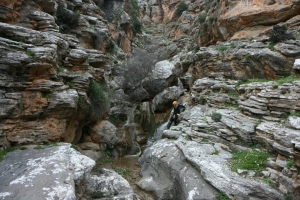
The Gorge of Ethia, officially known as Vorno, is located south of Heraklion, at the Asterousia Range. It starts from the village Ethia and, after tearing Asterousia northwards, it finishes at the plain of Messara, between the villages and Rotasi and Mesochori.
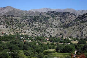
From Gerakari the European E4 trail continues for Elenes and then to Amari. Then it comes through the villages Opsigias, Petrohori, Vizari and Fourfouras. From there it ascends to Psiloritis Mount, via road (up to 760m. altitude) and trail, to reach the mountain shelter of Toumbotos Prinos. The route runs through a wooded and rough landscape, with mainly oak trees.
This part of the E4 European path runs along the main paved road connecting Askyfou with Asfendou and Kallikratis villages. The road crosses the scenic and wild east part of the White Mountains and has amazing views to their core to the west. It is suggested that you visit the path with a car.
Just a few meters to the west of Tsoutsouros, the very narrow and smaller gorge of Troulla is formed. Being shorter than the Tsoutsouros canyon, it has attracted the attention of the canyoners and is very impressive with more than 15 beautiful waterfalls along its bed, the largest being 15m high.
Also read:
- Home
 Beaches
 Nature
 Past
Past Destinations
 Highlights
 West Crete
- Central Crete
- East Crete
- Towns
- Chania Prefecture
- Chania
- Paleochora
- Kissamos
- Georgioupolis
- Chora Sfakion
- Loutro
- Rethymnon Prefecture
- Rethymnon
- Agia Galini
- Plakias
- Spili
- Anogia
- Heraklion Prefecture
- Heraklion
- Hersonissos
- Malia
- Matala
- Agia Pelagia`
- Archanes
- Kokkinos Pirgos
- Lassithi Prefecture
- Agios Nikolaos
- Elounda
- Sitia
- Ierapetra
- Makrigialos
- Palekastro
- Zakros
- Lassithi Plateau
- Get Prepared


