")


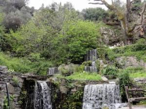
This section of the E4 European path is the last running on the east White Mountains and is entirely on a paved road. The road connecting Kallikratis village to Asi Gonia then heads to Argiroupolis. The views of the surrounding mountains and valleys and the lush green area of Argiroupolis Springs are the highlights of this route. As the path runs along a paved road, it is suggested that you visit it by car.

Canyon Kakoperatos located 10km south of Ahendrias village, on the eastern side of Asterousia Mountains. The distance from Heraklion is approximately 66km. The gorge is only crossed with technical equipment.

The gorge of the Holy Apostles in Lapathos is located south of Mount Dicti, 28km west of Ierapetra, 72km south of Heraklion, in the area of Kato Simi. This is a very rough canyon, which is a perfect challenge for very experienced canyoners. Its length is about 4km and the elevation difference between the starting and the ending point is about 900m.
The canyon of Tsoutsouras is located in Tsoutsouras village and is one of the many inaccessible canyons of the area. It starts at position Sfakias and it's exit is located near the settlement, in Larinaki area, and at first glance it causes awe.
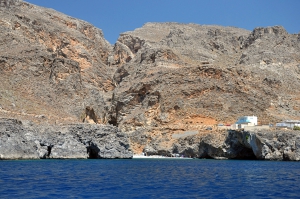
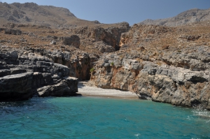
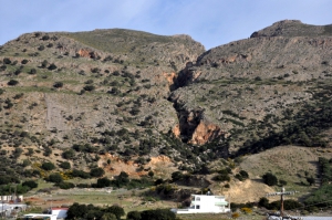
The wild and inaccessible canyon of Mesosfini is located 55km south of Heraklion city, in an isolated area west of the seaside village of Treis Ekklisies. Its entrance is located at a height of 450m, near the village of Mournies and Prinias, in the Asterousia Mountains. At its exit, 2km south, it is formed the majestic beach of Voidomatis, which can be accessed via a dirt track from Tris Ekklisies.

Crete may be an island, but its culture is closer to the mainland type. The inhabitants always preferred areas close to the mountains, where they could peacefully develop agriculture, livestock farming, and trade, as coastal areas were exposed to pirate and buccaneer raids. Several small villages, however, managed to survive and even thrive after the tourism boom.
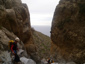
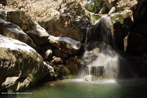
The gorge of Valahas is formed south of Heraklion and the beach Elygia is formed at its exit. The highest rapel is 50m high and 4 hours are required for its crossing (only with canyoning equipment). The lower part of the gorge is covered by pine trees.
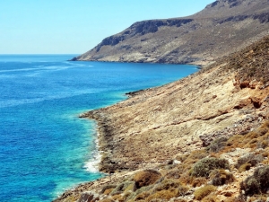
This part of the E4 path offers nice seascapes and is not too hard. From the organized beach of Kato Zakros, the course runs northwards, alongside the rocky coast. It comes by the Cave of Pelekita and the ancient quarry of Pelekita, from where Zakros Palace material was extracted, and finally reaches the beautiful beach of Karoumes, at the exit of Chohlakies gorge.
Also read:
- Home
 Beaches
 Nature
 Past
Past Destinations
 Highlights
 West Crete
- Central Crete
- East Crete
- Towns
- Chania Prefecture
- Chania
- Paleochora
- Kissamos
- Georgioupolis
- Chora Sfakion
- Loutro
- Rethymnon Prefecture
- Rethymnon
- Agia Galini
- Plakias
- Spili
- Anogia
- Heraklion Prefecture
- Heraklion
- Hersonissos
- Malia
- Matala
- Agia Pelagia`
- Archanes
- Kokkinos Pirgos
- Lassithi Prefecture
- Agios Nikolaos
- Elounda
- Sitia
- Ierapetra
- Makrigialos
- Palekastro
- Zakros
- Lassithi Plateau
- Get Prepared


