")


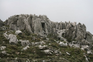
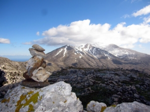
The route starts from Spili, reaches the spring of Agia Fotia, and then ascends to Kissos. It comes above the Monastery of the Holy Spirit and climbs to the summit of Mount Kedros (1776 m.). From there we go back and meet the trail that leads to the Church of the Prophet Elijah and descends to Gerakari. This route is a part of the European E4 trail.

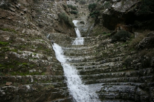
The gorge of Eligas is a monument of natural beauty located on the west side of the mountain Koupa near the village Miliaradon by Embaros. It is actually a high waterfall with nine rapels, ideal for canyoning. The difference of altitude between the entrance and the exit is about 230m.
The part of the European path E4 that connects Chora Sfakion with Frangokastelo and then with Rodakino is all on paved road and can be visited even by car.
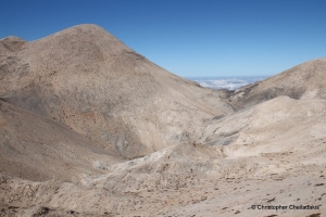
This is probably the harderst part of the entire Cretan E4 path, but also one of the most amazing sceneries you could ever imagine. The signing of E4 with poles and brushed marks is quite sufficient, but we have to be careful for not losing our directions. This course has some steep passages, thus it is not suggested to cross it in winter when snow is high.
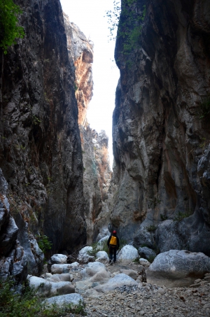
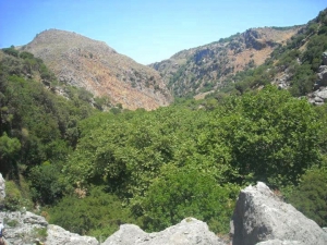
The canyon of Panagia (Virgin Mary), also known as Kalami I is parallel to the gorge Xerofarago or Kalami II and takes its name after the former monastery of Panagia Keralimeniotissa located at its exit.
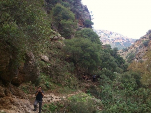
From Tzermiado the E4 European Trail follows the road that climbs to the plateau Onisimos. We cross the small plateau, where the church of St. Ariadne is sited, follow the uphill path that passes from the ancient terraces used for cultivation and reach the ancient settlement of Karfi. The view from the top is breathtaking.

The Gorge of Cyclamen or St George Gorge starts from the settlement Aletrouvari (altitude 300m), passes east of the village of Agios (St) Georgios and ends at the village Vandes (altitude 50 m).
Gorge Chalase or Porofarago starts near the village Sassalos and ends before the village Makronas after 4 hours of course in dense vegetation. Crossing it is not very easy because at one point it has a large scree (chalase) and there is no trail.
Also read:
- Home
 Beaches
 Nature
 Past
Past Destinations
 Highlights
 West Crete
- Central Crete
- East Crete
- Towns
- Chania Prefecture
- Chania
- Paleochora
- Kissamos
- Georgioupolis
- Chora Sfakion
- Loutro
- Rethymnon Prefecture
- Rethymnon
- Agia Galini
- Plakias
- Spili
- Anogia
- Heraklion Prefecture
- Heraklion
- Hersonissos
- Malia
- Matala
- Agia Pelagia`
- Archanes
- Kokkinos Pirgos
- Lassithi Prefecture
- Agios Nikolaos
- Elounda
- Sitia
- Ierapetra
- Makrigialos
- Palekastro
- Zakros
- Lassithi Plateau
- Get Prepared


