")


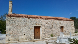
The cemeterial temple of Christ the Savior is dedicated to the Transfiguration of the Savior and is located in the village of Plemeniana in province Selino. It is built on the site of an Early Christian temple, as can be seen from the many marble architectural members that are embedded into the walls or are scattered around.

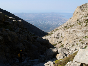
Το φαράγγι των Καμαρών, γνωστό ως Καμαραϊκό Φαράγγι ή Φάραγγα των Καμαρών, είναι το μεγαλύτερο φαράγγι στην περιοχή του χωριού Καμάρες της επαρχίας Πυργιωτίσσης στη νότια πλευρά του Ψηλορείτη.

The temple of Michael Archangel is hidden amidst centuries-old olive groves a few meters out of the settlement Sarakina, province Selino, and very close to the village cemetery. The church is built on the site of the middle aisle of a three-aisled and wooden-roofed early Christian basilica, from which part of the arch of the sanctuary is preserved.

Bogazi beach is formed in an isolated area on the borders of the community of Sisses in the province of Mylopotamos in the Talea Range, east of the German outpost of Pyrgos peak.

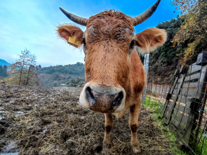
The short-horned cow of the Cretan breed today has many cows mainly in the Drakona area of the White Mountains and until recently was considered almost extinct..

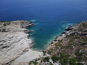
Glykys Kolymbos beach (or Glykos Kolymbos) is the westernmost of all the beaches in the area of the Tris Ekklisies in the Asterousia Mountains. It is a special place with impressive geological formations in the water, which from above look like stripes.

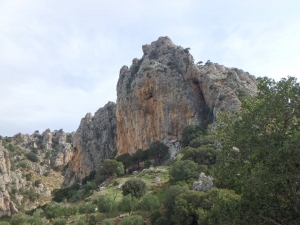
Πάνω από το απόκρημνο φαράγγι του Ανδριανού της επαρχίας Μιραμπέλου υψώνεται το βραχώδες έξαρμα της Φορτέτσας. Αυτόν τον αφιλόξενο, απόκρημνο και φυσικά οχυρωμένο βράχο επέλεξαν οι κατατρεγμένοι Μινωίτες για να εγκαταστήσουν μια μικρή πόλη κατά τη λεγόμενη Σκοτεινή Περίοδο.

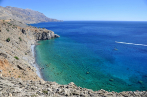
The river Mouselas flows through the valleys that form east of the White Mountains and flow into the western boundary of the large beach of Episkopi, in the large bay of Almyros that has the most rivers in Crete. It is the natural border of the prefectures of Chania and Rethymno.


