")


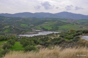
The dam of the Chalavrianos River is located in the rural area of Halavra in the district of Pano Archanes, south of Range Giouchtas, between the villages Houdetsi and Profitis Ilias. The Chalavrianos torrent, which feeds this artificial lake, is a tributary of the River Giofyros.

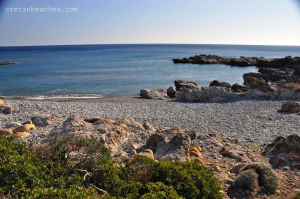
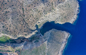
Plakaki is the westernmost cove formed between Paleochora and Grammenos. It is hidden by the rocks and well protected from the winds.

Karavostasi beach is the westernmost of the beaches of the village Kalo Chorio at province Mirabelo, approximately 12 kilometers southeast of Agios Nikolaos and 22 kilometers north of Ierapetra.

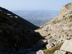
The gorge of Kamares, known as Kamaraiko Gorge, is the largest canyon in the area of Kamares village of Pyrgiotissa province on the south side of Psiloritis. We meet its imposing exit in a steep turn a few meters west of the village, on the main road to Lochria.
The beach Manovas is located just 500 meters south of the famous Seitan Limania beach at cape Akrotiri or Melecha and has a western orientation. It is formed in a deep ravine at the westernmost end of cape Akrotiri.

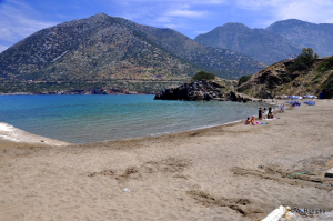
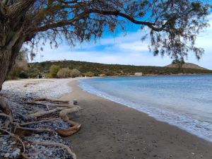
In front of the village center, there is the enclosed bay of Varkotopos with a beautiful beach with sand and gravel in front, which is very well organized and busy. It is ideal for young children.

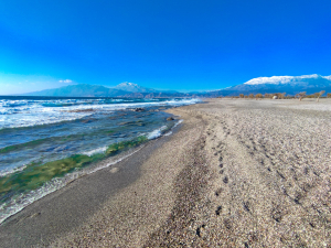
The beach of Pachia Ammos in the position Afrathias (or Afratias) is formed between the airport of Tymbaki and the seaside settlement Kalamaki. Although it is actually the longest beach in Mesara, it is also the less busy.

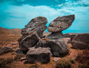
A very interesting geological attraction is the rocks that resemble giant anthropomorphic figures in the Asterousia range. These figures, like marble gods that were worshiped in antiquity, even today dominate a ridge north of the village Paranymfi.
Also read:

- Home
 Beaches
 Nature
 Past
Past Destinations
 Highlights
 West Crete
- Central Crete
- East Crete
- Towns
- Chania Prefecture
- Chania
- Paleochora
- Kissamos
- Georgioupolis
- Chora Sfakion
- Loutro
- Rethymnon Prefecture
- Rethymnon
- Agia Galini
- Plakias
- Spili
- Anogia
- Heraklion Prefecture
- Heraklion
- Hersonissos
- Malia
- Matala
- Agia Pelagia`
- Archanes
- Kokkinos Pirgos
- Lassithi Prefecture
- Agios Nikolaos
- Elounda
- Sitia
- Ierapetra
- Makrigialos
- Palekastro
- Zakros
- Lassithi Plateau
- Get Prepared


