")


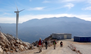
Koutsotroulis or Koutsotroulos is the highest peak of the Talean Mountains reaching an altitude of 1084m. Access to the top is possible via a dirt road that starts approximately at the middle of the road connecting the village Doxaro with the Monastery Vossako. This dirt road serves the wind park that is installed at the top of Koutsoroulis.

One of the highlights of ancient Ierapetra was the Naumachia (naval battle), a maritime theater where bloody battles were performed by prisoners and slaves of the Roman Empire. This was the transfer of arenas to the marine environment. The Naumachia was inspired by Julius Caesar in 46 BC.

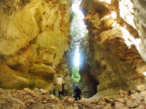
The small, but beautiful, Kaliakoudes Gorge is formed in the area between the villages of Paidohori, Nio Chorio and Machairi in the province of Apokoronas, Chania. It is basically a continuation of the stream of Skotini, which constitutes a tributary of the River Kiliaris. The canyon is only 1.5 km long, it has about 6 rapels and the entire length of the gorge requires the use of technical canyoning equipment (ropes). The highest of the descents is about 8 meters high.

Egglezos Cave or Cave of the Guerillas is located in an isolated area of the cypress wood of Tsivi, at position Asfendami. In this small cave, during the Second World War, British soldiers and local allies were hiding.
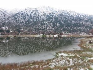
On the southern side of the Omalos Plateau in the White Mountains and between the starting point of the Samaria Gorge and Seliniotikos Giros, a seasonal lake of about 0.8 hectares is formed, which is covered by snow in winter. More small lakes are formed on the plateau in winter, with this one being the largest.
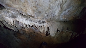
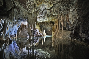
Cave Stratomytis or Lykastos Cave is located north of the settlement Karnari, just at the point where the solid limestone of Yiuhtas Mount meets the soil grounds of the region. It is very easily accessible via a short path and its location is easy found, as its numerous entrances can be seen from afar. The cave actually consists of a complex network of galleries, which exceed the length of 400 meters.

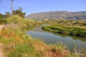
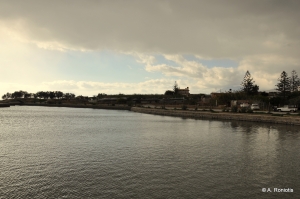
The River Moronis or Pera collects its waters from the wider area of Souda and Chania Crafts Park and transfers them to Souda beach. Its overall length does not exceed 5km, but it is important as it flows all year round.
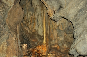
The Cave of Big Psistraki is a precipice located at an altitude of 950m, in the area of Evdomos and in the area of the village Gonies. Its total depth reaches 140m and has a length of approximately 90m. From its small entrance a 60 meter trench descends to the bottom, with a loft in the middle.
Also read:
- Home
 Beaches
 Nature
 Past
Past Destinations
 Highlights
 West Crete
- Central Crete
- East Crete
- Towns
- Chania Prefecture
- Chania
- Paleochora
- Kissamos
- Georgioupolis
- Chora Sfakion
- Loutro
- Rethymnon Prefecture
- Rethymnon
- Agia Galini
- Plakias
- Spili
- Anogia
- Heraklion Prefecture
- Heraklion
- Hersonissos
- Malia
- Matala
- Agia Pelagia`
- Archanes
- Kokkinos Pirgos
- Lassithi Prefecture
- Agios Nikolaos
- Elounda
- Sitia
- Ierapetra
- Makrigialos
- Palekastro
- Zakros
- Lassithi Plateau
- Get Prepared


