")


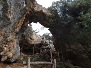
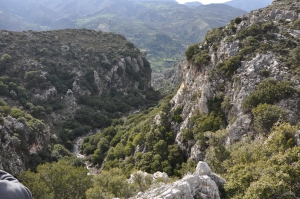
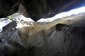
Approximately two kilometers northwest of the village Karines at position Faragi there is a small but impressive gorge, Kariniotiko Gorge. Kariniotiko canyon is completely unknown as the entire surrounding area is not included in the tourist routes. However, the surrounding area has exceptional natural beauty and hosts one of the most impressive oak wood of Crete with huge ancient trees.
Platys (i.e. wide) river is one of the rivers of foremost importance in Crete, flowing all year round. It gathers almost all water quantities of Amari Valley and leads them to the beach of Agia Galini. At a secret location between the settlements Agia Paraskevi, Vyzari, and Petrohori, the wide river gets narrow and forms two impressive ravines. The first is the small Mesa Faragi (inner gorge), reminding of the gorge of Kourtaliotis.
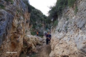
Gorge Smiliano or Kalamafka is located north of the village Ano Meros, about 100km southwest of Heraklion city. Through the gorge runs the Lygiotis river which is supplied by the valleys of Gerakari and the slopes of Samitos Mount. The canyon has a lot of water in winter and crossing it, by any means, is very tough.
The beautiful canyon Galliano starts southeast of Gallos and ends at the town of Rethymnon. It is 5.5km long and the walk is along a verdant ravine. Along the way we meet the mill of Saounatsides used till the 20th century, with traces of an old chapel next to it. In the gorge there is also the temple of St Anthony.

The lush canyon of Vederi starts from the village Fratzeskiana Metohia, passes next to the village Vederi and ends on the beach of Gerani (after 7km). The canyon has dense vegetation that makes trekking very difficult, as there is no footpath along its length.
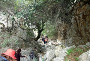
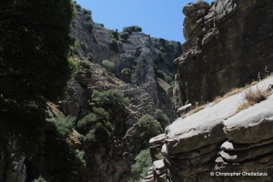
Platania Gorge is located in the Amari valley, 38km southeast of Rethymno, on the western outskirts of Psiloritis. It is a unique trail, with impressive cliffs, vertical limestone rocks, rock roofs and caves. The trail is recommended for experienced mountaineers, although the first part of the trek is quite easy and well pathed, even for children who are physically fit.
Kollita Gorges, i.e. Twin Ravines are located nearby the picturesque village Argyroupolis, about 22km southwest of Rethymnon city. They are named so, as they consist of two parallel canyons that end near Kato Poros settlement. Here we refer to the easternmost gorge of Moundros.
Kissano Gorge is located 1km north of Kissos village, in Amari valley, and 34km southeast of Rethymnon, connecting the village το the small plateau of Gious Kambos. It is a short, but beautiful gorge, crossed by the rural road of the area.
The canyon of Zoniana is located south of Zoniana village. Starting at an altitude of 950m, it ends at the village at an altitude of 650m. Through the gorge runs the "serpentine" Oaxis river that has water till spring. The gorge is easily accessible and safe for hiking, as its slope is small.
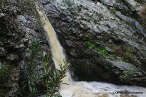
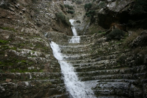
1.5km east of Spili, next to the main road connecting Spili to Agia Galini, you will meet the chapel of Agia Fotini, also known as Agia Fotia. Next to the road, you will find the springs of Agia Fotia, an old mill and a quite high waterfall (in winter).

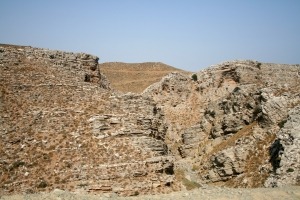
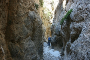
Achendrias gorge is located about 52km south of Heraklion, is approximately 8km long and ends on the beach Maridaki. It crosses the arid landscape of Asterousia Range that is characterized by bare mountains, sharp rocks and rough pasture lands. Throughout most of its length it is easily accessible and is dry in summer.
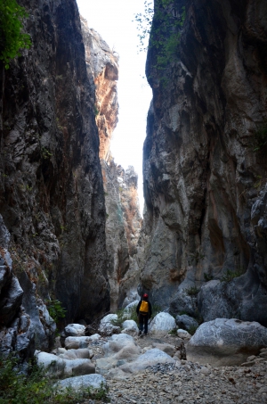
The Gorge of Agia Anastasia starts from Kenourgio Horio, Province Pediada (altitude 160m) and ending at the seaside settlement of Gournes. The name is taken after the cavernous chapel of St. Anastasia, located near its entrance. The vegetation is restricted to oleanders and the walls get narrow in several points. The descent of the gorge takes about three hours.
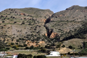
One of the most impressive and longest canyons of the entire island of Crete is the canyon with the cacophonous name Psoraris (Greek: someone who suffers from scabies). Its exit is located at the mountains of Dikti, above the village Geraki and it starts from the plateau Parasyrta. There are three different mountain roads, all of unique beauty: from Lassithi plateau (village Kaminaki), from Geraki and Katofygi by Viannos.
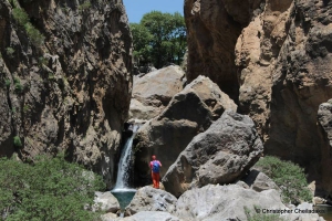
The gorge of Eligas is a monument of natural beauty located on the west side of the mountain Koupa near the village Miliaradon by Embaros. It is actually a high waterfall with nine rapels, ideal for canyoning. The difference of altitude between the entrance and the exit is about 230m.
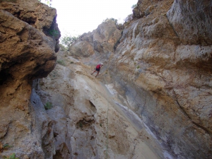
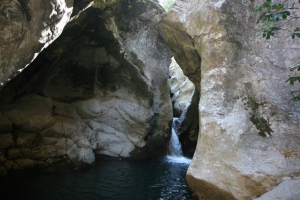
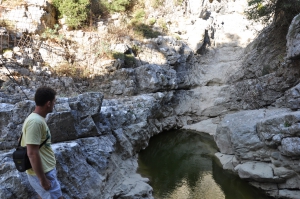
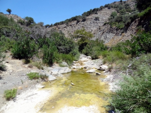
The gorge of Psaro Nero is located 55km southeast of Heraklion. It is a short inaccessible canyon with high waterfalls (rapels), very well known to canyoners of Crete. Psaro Nero with its wonderful rock formations has water till late spring. It is initially open and closes abruptly close to the end, where the high rappels are (the highest is 25m). The gorge empties into Baritis River, a tributary of Anapodaris, near Katofygi.
On the southeast side of Afendis Christos summit, above the villages Embaros you will meet the verdant vineyards at Erganos plateau at 900 meters altitude. The water gathered from the melting snow of the surrounding slopes and from many springs of the region form the main tributary of the Anapodaris river, Baritis, which crosses the plateau of Erganos and forms the rugged canyon of Erganos.
The canyon of Panagia (Virgin Mary), also known as Kalami I is parallel to the gorge Xerofarago or Kalami II and takes its name after the former monastery of Panagia Keralimeniotissa located at its exit.
Xerofarago Gorge is located south of Kalami village (Viannos area), 75km southeast of Heraklion. It is a small gorge ideal for canyoning (known to the canyoners as Kalami II) that terminates close to the old church of Panagia Keralimeniotissa, where another gorge, Kalami Gorge ends.
The canyon of Tsoutsouras is located in Tsoutsouras village and is one of the many inaccessible canyons of the area. It starts at position Sfakias and it's exit is located near the settlement, in Larinaki area, and at first glance it causes awe.
The gorge of Mindris starts near the village Filippi and ends at the port of Tsoutsouras, after running a distance of 6km. It is a open canyon without vertical walls, which’s riverbed is dry in summer and very easy to walk. On the riverside traces of ancient settlements, ranging from the Minoan to Roman Era have been found.
Also read:
- Home
 Beaches
 Nature
 Past
Past Destinations
 Highlights
 West Crete
- Central Crete
- East Crete
- Towns
- Chania Prefecture
- Chania
- Paleochora
- Kissamos
- Georgioupolis
- Chora Sfakion
- Loutro
- Rethymnon Prefecture
- Rethymnon
- Agia Galini
- Plakias
- Spili
- Anogia
- Heraklion Prefecture
- Heraklion
- Hersonissos
- Malia
- Matala
- Agia Pelagia`
- Archanes
- Kokkinos Pirgos
- Lassithi Prefecture
- Agios Nikolaos
- Elounda
- Sitia
- Ierapetra
- Makrigialos
- Palekastro
- Zakros
- Lassithi Plateau
- Get Prepared


