")


The Gorge of Ethia, officially known as Vorno, is located south of Heraklion, at the Asterousia Range. It starts from the village Ethia and, after tearing Asterousia northwards, it finishes at the plain of Messara, between the villages and Rotasi and Mesochori.
A very wild gorge starting from the valley of Pervola, next to Mournia village at Asterousia Mounts, and ending on the remote amazing beach of Kaminaki. There is a trail, quite steep, starting from Pervola.
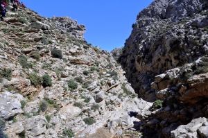
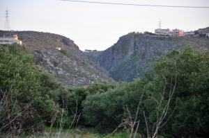
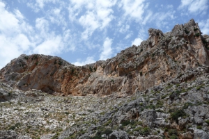
The wild and inaccessible canyon of Mesosfini is located 55km south of Heraklion city, in an isolated area west of the seaside village of Treis Ekklisies. Its entrance is located at a height of 450m, near the village of Mournies and Prinias, in the Asterousia Mountains. At its exit, 2km south, it is formed the majestic beach of Voidomatis, which can be accessed via a dirt track from Tris Ekklisies.
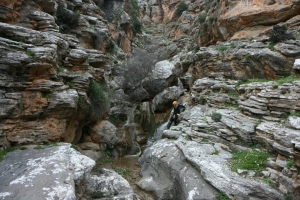
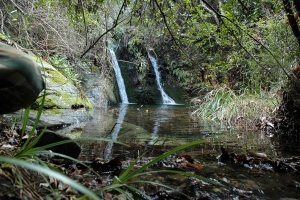
Just a few meters to the west of Tsoutsouros, the very narrow and smaller gorge of Troulla is formed. Being shorter than the Tsoutsouros canyon, it has attracted the attention of the canyoners and is very impressive with more than 15 beautiful waterfalls along its bed, the largest being 15m high.
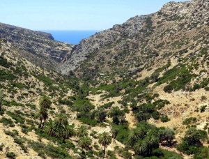
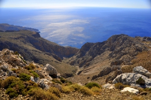
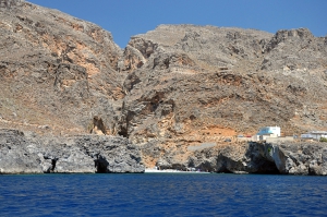
Martsalo gorge has a length of about 2km and is located in the south coast of Asterousia Mountains, in Heraklion Prefecture. It starts from the north and ends at the Libyan Sea, in the small picturesque beach of Martsalo. Apostle Paul stopped in Martsalo, during his journey to Rome.
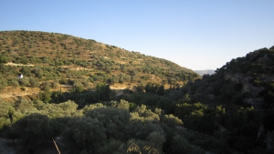
Apolychnos Gorge is located a few kilometers north of Mires town, in a lush green area with dense olive groves. It's actually a narrow valley running along a river, which in some places gets deeper and the vegetation is very dense.
A few minutes away from the city of Heraklion, close to Agios Panteleimonas Monastery by Fodele, there is the canyon of Santorinios. The canyon is short but has not been exploited yet due to its quite difficult access, because of the dense vegetation and many ponds.
West of the village Rogdia a small gorge is formed that exits at the area of Paliokastro. It initially starts at position Koukos, where we meet the ruins of an old watermill.
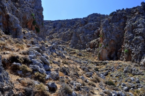
The Gorge Porofarago or Sfakoryako is a small canyon, almost 2 km long, starting from village Kato Vatheia and ending near the settlement of Vrachokipos. It is crossed by the river Krommidas carrying water on the beach Kokini Hani.
The Gorge of Ambelos is located southeast of Gonies village (Hersonissos Municipality), just about one km from the southern limits of the village. The approach is easy from the rural road, which runs through the gorge, along the bed of a tributary of Aposelemis river.
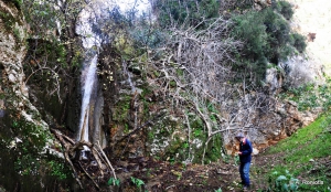
Gorge of Embasa starts its course from the village Kato Kera and ends near the village Gonies, being about 2km long. Its upper part is very steep and in winter several waterfalls are formed, with the highest being about 20m high.
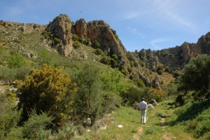
The Knosano Gorge (or gorge of Saint Eirini) is the continuation of Mount Giouchta. It extends south of Archanes (Saint Mamas) it runs through Archanes in Kato Milos, where starts the subpart of Knossano gorge known as Sylamos Gorge, after the nearby village. This part is very beautiful with smooth cavernous rocks and huge plane trees, and is easily accessible by car as the road connecting Arhanes to Sylamos runs along the riverbed.
Spiliotissa gorge is located about 24km south of Heraklion. It is a lush ravine that runs from the village Houdetsi, crosses Agios Vasilios, and ends in the valley of Peza. The best part of it is that between Houdetsi and Agios Vasilios (1.5km long).
The gorge of Saint Charalambos is a small, but beautiful canyon located south of village Ano Asites. It takes its name after the church of Saint Charalambos located at its beginning. Till the middle of spring, the gorge has water, forcing hikers to traverse (to hike along its walls).
The gorge of Gaidourorachi or Kroussonas is located 3km west of the village Kroussonas and crosses the Psiloritis Mt. Starting from ancient Zominthos, near Anogia, it ends at Kitharida village, near Kroussonas.
The Goniano gorge is the unique passage which connects Sklavokampos and Gonies with Tylisos. Its length is 3 km. and is relatively wide and straight. Reaching though the exit (in the point where a monument of those killed during the 2nd World War is in the road to Gonies) the gorge turns abruptly towards south and before it comes out of the limestone mass follows an irregular and abrupt course.

The gorge of Agia Irini by Ziros is actually a set of two parallel canyons that merge shortly before the sea, at the point where the dirt road passes to the beach of Agia Irini. Both canyons are very wild, rocky, with steep slopes and high walls. Especially the westernmost of the two branches is quite eerie and dangerous for those who have no experience of hiking in canyons (still it is not technical).
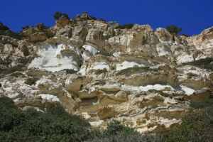
Agii Pantes Gorge is located next to Skopi of Sitia province, near Faneromeni Monastery, and is one of the easiest places to walk in Crete. The very well signed trail runs along the riverbed of the gorge, below the shade of hundreds platan trees. There are two fresh water springs in the canyon, one is called Koutsounari and the other one, located inside a cave, is called Hosto Nero. The exit of the gorge is the beach of Agii Pantes (by Platani beach). The area floods in winter turns to an important wetland. Near its exit, you will admire the white limestock formations, reminding of huge pleurotus mushrooms.
A very short gorge with the small wonderful beach of Agriomandra formed at its exit. To find that you should follow the dirt road that crosses the green meadows west of Kavoussi, known as Lakos Ambelion position, till the entrance to the gorge.
The gorge of Adrianos starts from the village Adrianos. In some places there are high rocks that impede the free course through the canyon, making walking difficult, but not impossible (the course needs about 3 hours). The river flowing in its bed is Skoulikaris that starts near village Potami and it empties in the town of Agios Nikolaos.
Also read:
- Home
 Beaches
 Nature
 Past
Past Destinations
 Highlights
 West Crete
- Central Crete
- East Crete
- Towns
- Chania Prefecture
- Chania
- Paleochora
- Kissamos
- Georgioupolis
- Chora Sfakion
- Loutro
- Rethymnon Prefecture
- Rethymnon
- Agia Galini
- Plakias
- Spili
- Anogia
- Heraklion Prefecture
- Heraklion
- Hersonissos
- Malia
- Matala
- Agia Pelagia`
- Archanes
- Kokkinos Pirgos
- Lassithi Prefecture
- Agios Nikolaos
- Elounda
- Sitia
- Ierapetra
- Makrigialos
- Palekastro
- Zakros
- Lassithi Plateau
- Get Prepared


